


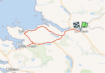
J-24-06 Leenaun - Parc National Connemara - 48 km

jeanmarcMasson
Gebruiker GUIDE

Lengte
48 km

Max. hoogte
77 m

Positief hoogteverschil
523 m
Km-Effort
55 km

Min. hoogte
0 m

Negatief hoogteverschil
522 m
Boucle
Ja
Datum van aanmaak :
2024-05-23 07:35:32.243
Laatste wijziging :
2024-05-23 07:38:10.933
1h00
Moeilijkheid : Heel gemakkelijk

Gratisgps-wandelapplicatie
 SityTrail
IGN / Geografische instituten
SityTrail Plus
De wereld gaat voor u open
Over ons
Tocht Auto van 48 km beschikbaar op Onbekend, County Galway, Conamara Municipal District. Deze tocht wordt voorgesteld door jeanmarcMasson.
Plaatsbepaling
Land:
Ireland
Regio :
Onbekend
Departement/Provincie :
County Galway
Gemeente :
Conamara Municipal District
Locatie:
Letterbrickaun ED
Vertrek:(Dec)
Vertrek:(UTM)
453838 ; 5938729 (29U) N.
Opmerkingen